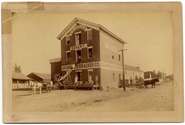
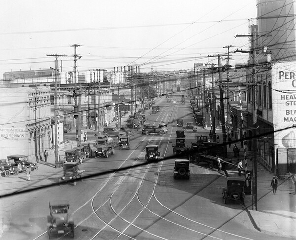
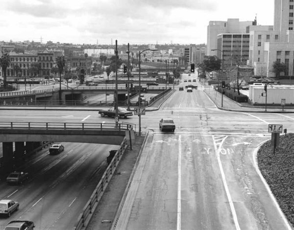
Photos: Aliso Street, Before It Became the 101 Freeway

When C. C. Pierce balanced his tripod on the roof of the Maier and Zobelein Brewery on Feb. 22, 1899, and pointed his camera west toward the city of Los Angeles, he never could have envisioned how time would obliterate the scene he was capturing. Perhaps he could accept that steel towers would one day supplant the two hulking structures whose clocktowers then pierced the the city's skyline -- the county courthouse on the left and the high school on the right. But how could this 19th-century photographer ever comprehend the idea of a freeway -- automobiles speeding over concrete at sixty miles per hour -- where Aliso Street, that broad avenue running down the center of the photo, had reigned for so long?

Aliso Street was already an ancient route when Pierce photographed it in 1899. Sergeant Jose Arguello noted its existence on his 1786 diseño of the newly founded pueblo, describing it as the main highway between the pueblo and Mission San Gabriel. In fact, it almost certainly predated both, as the Spanish likely repurposed a well-worn footpath used by the Gabrielino (Tongva) inhabitants of Yang-na. Soon the highway rambled through a matrix of vineyards and by the 1830s it had acquired its name, Aliso Road, in honor of a huge sycamore tree that shaded the wine cellars of Don Jean-Louis Vignes.
The vineyards of Aliso Road might have been the pride of Los Angeles (the city was an early leader in viticulture), but a more shameful episode in the city's history transpired just south of the road. in 1836, the ayuntamiento (town council) forcibly relocated the remaining inhabitants of Yang-na to a parcel near Aliso's intersection with Alameda. Already decimated by disease and decades of missionization, Yangna's population now mingled with Indian laborers from across Southern California in what became known as the "rancheria of poblanos." It survived only ten years. In 1845, responding to complaints that the rancheria's inhabitants had been bathing in the town's zanjas, the ayuntamiento forced the villagers to abandon their thatched huts once again and move across the river to the present-day site of Boyle Heights.
Soon after the American conquest of California, an influx of newcomers transformed the old road into a major business corridor. In 1855, the city rerouted part of the highway to straighten its approach to the river. What had been "a willow-bordered, picturesque little lane...[that] paralleled [Vignes'] grape-arbor as far as the river-bank," in the words of memoirist Harris Newmark, was widened into Aliso Street. The older route survived as Old Aliso Road (later renamed Lyon Street) and veered off at an angle at the Vignes winery.

By 1899, when Pierce trained his camera on Aliso Street, it was home to several notable institutions, including one of the city's first breweries (which opened in 1874) and its first medical school (which opened in 1885 and, in a strange twist of history, changed its affiliation from USC to the University of California in 1909). And at its junction with Los Angeles Street, Aliso flowed into the city's original Chinatown.
As the principal route into the city from points south and east, Aliso was the site of several milestones in L.A.'s transportation history. In 1873, the county built the first vehicular bridge over the Los Angeles River along Old Aliso Road. A span along the newer Aliso Street followed soon after, and by 1877 the horse-drawn cars of one of L.A.'s first street railways began rolling down Aliso, connecting Los Angeles with the budding suburbs of Boyle Heights and East Los Angeles.
But Aliso Street made its greatest contribution to the development of Southern California's freeway network. After plans emerged in the early 1930s for a unified passenger rail station just north of Aliso, a chain of events -- recounted in detail by Auto Club archivist and historian Matthew Roth in the Getty's recent book "Los Angeles Union Station" -- routed two early freeways over Aliso Street's viaduct over the Los Angeles River. That determined the future structure and placement of the city's freeway grid, as Roth argues, including the location of the massive, triumphant Four Level Interchange. It also meant that by 1953 the once-dusty road known as Aliso Street would morph into the eight-lane 101 freeway -- a development Pierce likely never anticipated.


