Exploring Foothill Transit's 187 Line
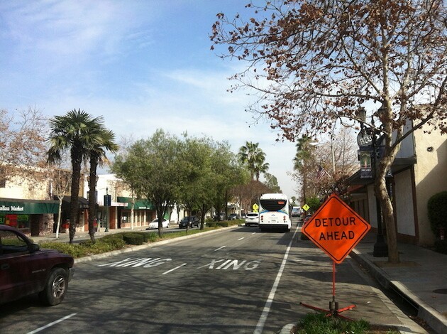
Foothill Transit, one of Southern California's many public transportation agencies, recently turned 25 years old. It may come as something of a surprise then, that at this still youthful age it's one of the regions's oldest transit agencies. Although probably less recognized than Metrolink (established in 1992) or Metro (established in 1993), it's truly a major carrier -- covering as it does an area of roughly 300 square miles and 22 Southland cities.
Although most the San Diego-sized area that Foothill Transit serves is located within the San Gabriel Valley, the agency also serves parts of Southeast Los Angeles County, Orange County, the Inland Empire, the Pomona Valley, Downtown Los Angeles's Civic Center and South Park, Westlake, and the Koreatown neighborhood in Los Angeles's Midtown -- in other words, much more than just the Foothills for which it's named.

Foothill Transit was born out of cutbacks to bus service made by Metro's predecessor, Southern California Rapid Transit District (SCRTD). At its inception, Foothill Transit operated the fourteen lines that SCRTD had dropped. In the past 25 years the number of lines that it operates has more than doubled, and today Foothill Transit includes both local buses and commuter express lines. Foothill Transit also connects with several other local transit networks, including Metro and Metrolink trains as well as the buses of Baldwin Park Transit, Duarte Transit, Montebello Bus Lines, Monrovia Transit, Pasadena (ARTS), West Covina's Go West, and Norwalk Transit.
A few months ago Foothill Transit opened their first agency-owned park and ride in the City of Industry. A new line, the 495, provides one direction/non-stop service from the Industry station to Union Station during morning peak hours and return service in the afternoon.
Since the San Gabriel Valley is perhaps my favorite region in the county, I have long eyed using Foothill Transit to explore it.
When I contacted the agency, their Transportation Director of Marketing and Communications, Felicia Friesema, suggested the 187 line, the network's most popular, and one that stretches about thirty miles from Montclair to Pasadena. To aid me in my quest I was temporarily entrusted with the possession of a magic transit ring -- the only one of its kind -- which allowed me to hop off an on various buses at the many stops and explore the attractions in the route's vicinity.

*****
Montclair
My journey began at the Montclair Transcenter in Montclair, a city located in the Inland Empire. No disrespect intended to Montclair, but for most travelers the city's Transcenter is probably nothing more than a stop on the way to somewhere else, with several other networks connecting there, including Metrolink, San Bernardino's OmniTrans, Riverside Transit, and other Foothill Transit lines. Another type of connection is the 20 mile Pacific Electric Trail, which passes near the station and offers cyclists an alternative route between Rialto and Claremont, as well as as a reminder of just how extensive the old Red Car network was. Other than the station's apparent remoteness, and the heavy funk of livestock in the air, I didn't immediately sense much else of interest and so quickly boarded the first 187 bus heading west.

Claremont
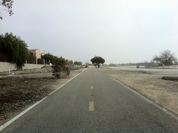
Although their names and population sizes are similar and they're physically separated by little more than the San Antonio Creek (and an invisible county line), the two neighboring cities of Claremont and Montclair appear to have little in common with one another. One is a culturally-rich college town that is almost the Medina to Pasadena's Mecca. The other is Montclair.
The 187 stops at the Claremont TransCenter (also referred to as the Claremont Metrolink Station), a handsome Spanish Colonial Revival station built by the Atchison, Topeka and Santa Fe Railway in 1927. The station is located just south of Claremont Village -- a truly charming shopping district (home to Rhino Records, Video Paradiso, the Folk Music Center, and the shops in the Packing House) and an attractive civic center, many of the buildings of which are more fine examples of Spanish Colonial Revival style.
Just east of the village are the Claremont Colleges -- a consortium of seven schools occupying a single square mile. The campuses are home to libraries, radio station KSPC 88.7, the Pomona College Museum of Art, Mabel Shaw Bridges Hall of Music ("Little Bridges"), Bridges Auditorium ("Big Bridges"), the John R. Rodman Arboretum, and other sites of interest, not just to students and faculty. After turning north up Indian Hill Boulevard, the 187 again turns west to head down Foothill Boulevard -- historically part of Route 66. A short walk west of the turn is the 86 acre Rancho Santa Ana Botanic Garden.


La Verne
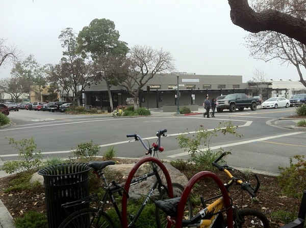
That Foothill Boulevard was formerly part of Route 66 is still evident from the many unmistakably mid-20th century restaurants (many of which feature Googie architectural elemenents and/or neon signage) which line it -- as well as the numerous trailer parks. Between Claremont and the city of La Verne lies a small, northern section of the city of Pomona -- the unspectacular Foothill Corridor neighborhood. Just across the border in La Verne is La Paloma, a Mexican eatery which dates back to 1966 when it opened as Wilson's Restaurant.
Other than La Paloma, this stretch of La Verne is mostly characterized by the presence of many red tile strip malls containing commonplace fast food franchises, nail salons, payday loans, and the like. The name "La Verne" is derived from the Old French "Vernon," which means "alder grove," and although I didn't notice any alder trees in the area, La Verne is fairly green (if not as much as Claremont is), clean, and perhaps a little sleepy. In fact, the sight of a man hoisting an American flag at Cost + Mattress was as exciting as anything I saw during my short time there.

San Dimas
After crossing Puddingstone Channel, the 187 arrives in San Dimas, a community which straddles the Pomona and San Gabriel valleys and is perhaps best known as the home to California's largest water park (Raging Waters) and the fictional time-traveling duo, Bill & Ted of the films Bill & Ted's Excellent Adventure and its sequel, Bill & Ted's Bogus Journey.
More recently San Dimas was in the news (well hyper-local blogs at least) because the city decided to remove their downtown's kitschy Wild West décor, partly on the grounds that San Dimas (at one time known as "Mud Springs") was never really a frontier town and that the false fronts and wooden sidewalks, installed in the 1970s, had nothing to do with the town's history. Although few would characterize Southern California as a place especially concerned with authenticity or hostile to charming chintz, the good folks of San Dimas could no longer tolerate the tacky, frontier facade, and was summarily stripped away.
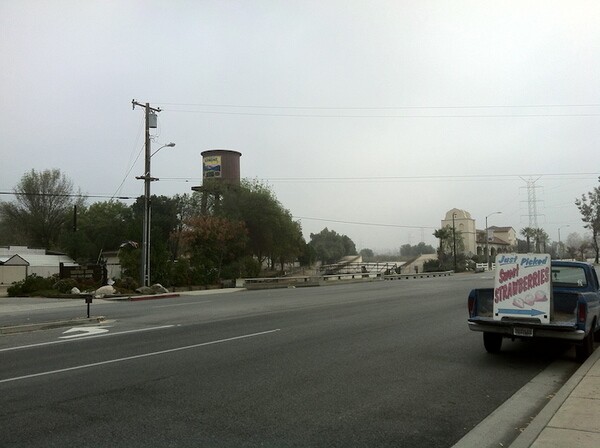
Even though San Dimas seems apparently eager to shed its Knott's Berry Farm-like image, the 187 still passes by places like the Horse Mart, Horsethief Canyon Park, and the dusty San Dimas Equestrian Center, located right across the creek (San Dimas Wash) from Strawberry Farms (and the decorative wooden wagon parked out front). One of San Dimas's old Route 66 roadside restaurants that the 187 stops near is Pinnacle Peak Steak House, which opened in 1967 (on the old site of a stagecoach stop), and where non-bolo tie neckties will supposedly be clipped from the wearer's neck.
Glendora
Dividing the city of Glendora in two are the South Hills, which rises dramatically from its flat surroundings. The 187 passes between that landform and the foothills of the San Gabriel Mountains to the north, both of which contribute to the area's sense of remoteness. Many of the lower canyons of the South Hills are developed residentially, but most of the steep hills above are a wilderness area and home to the roughly 200 acre South Hills Park.
At some point Glendora changed the name of Alosta Avenue back to Route 66 and the city is still home to several interesting Route 66-era restaurants, the oldest of which is the Golden Spur. That establishment is said to have been founded over 95 years ago, although the building in which it's located seems to date back to 1932. Angelo's Burgers was founded in 1975, but is located in a drive-thru constructed in 1959 -- the same year that the building housing the nearby dive bar Our Place was built. El Amigo was founded in 1980 but is located in a building dating from 1968, which though it was resembles Wienerschnitzel probably never was one, since there's a still-extant Wienerschnitzel located right across the street that's been there since 1965. The barn-like Altadena Drive-In Dairy, Pepper Tree Cafe, and Flappy Jack's Pancake House proved harder to obtain any historical information about, but all have that Route 66 vibe.
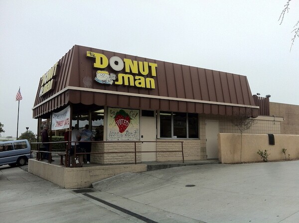
Improbable though it may sound, probably the best-loved restaurant in Glendora is one of the least interesting looking from the outside -- the 24-hour donut joint, The Donut Man. The donut man in question is one Jim Nakano, who bought a Foster's Donuts franchise in 1972. In 1974, he and his wife Miyoko began selling their most famous creation, the seasonal fresh strawberry donut. I picked up two of those and have every intention of returning when their peach counterparts come into season.
At the western edge of Glendora is Citrus College, founded in 1915, making it the oldest community college in the county. As with most colleges, Citrus provides cultural offerings of interest to the not-collegiate public, as well as students and facutly. Perhaps most notably, the Haugh Performing Arts Center hosts about 140 live performances per year. The campus is also home to an herbarium, the Citrus College Little Theatre, and other attractions.


Azusa
In 2015 Azusa will become the new eastern terminus of Metro's Gold Line. It's also the middle point along the 187 line. Situated at Azusa's eastern edge is the campus of Azusa Pacific University, home to the Duke Art Gallery, Munson Recital Hall, Warehouse Theater, Mary Hill Theater, and more. Just west of that is the former site of the Azusa Foothill Drive-In Theater, which opened in 1961 and closed long ago, but is still home to an eye-catching marquee.
A little west of the university's campus is downtown Azusa which, while perhaps not as stunning as the downtowns that roughly bookend the 187 line, does possess a quaint and understated charm. Downtown Azusa is home to Azusa's library, city hall, and the old Atchison, Topeka, and Santa Fe train station. A little west of the campus is the historic Lindley-Scott House and Gardens -- built in 1901 and apparently now mostly used as a wedding space.

Irwindale
I've previously compared the roughly 10 square miles (25 square kilometers) city of Irwindale to the fictional land of Mordor. The city is dominated by the presence of seventeen gravel pits and the not-unpleasant sound of tumbling rocks and machinery is audible for much of the day. Since 1980, foul smells have emanated from the macrobrew-producing MillerCoors factory. The city is also home to Irwindale Speedway and the Southern California Renaissance Pleasure Faire, but it wasn't until after Huy Fong (manufacturers of America's most popular version of Thai sriracha) moved to the city in 2010 that some of the 1,500 residents and the city decided to file a lawsuit claiming that the scent of chiles and garlic (and perhaps settlement money) is a public nuisance.
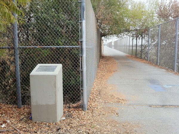
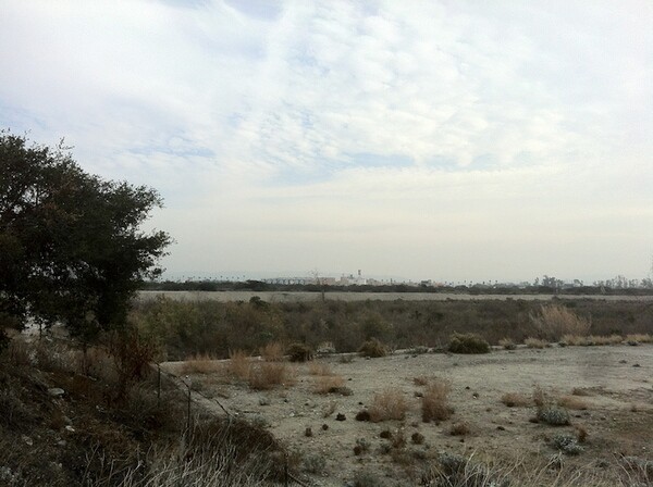
Irwindale isn't all foul odors, thumping rocks, and pounding machinery though. Standing on the Puente Largo Railway Bridge (built in 1902 for the ATSF railway and technically across the border in Azusa) the dominant smell was of white sage, and it was quiet enough to hear the crash of underbrush as a hawk swooped down and moments later landed on a branch with its prey. The bridge spans the San Gabriel River, connecting to a bike trail on one bank, with a horse and pedestrian trail on the other. The San Gabriel River Trail runs 39 miles from the Angeles Forest to the north, all the way to the Pacific Ocean where its mouth empties between Long Beach and Seal Beach.

Duarte
Just west of the San Gabriel River Trail is another oasis of tranquilty, Encanto Park, in the city of Duarte. The park is also home to the Duarte Historical Museum, which is only open on Saturdays and the first and third Wednesdays of any given month.
Duarte is home, like most of the Foothill communities, to its share of outwardly interchangeable strip malls, but unlike most of the unremarkable shopping centers to the east, those in Duarte often contain within them shops that are more interesting and reflective of the community's character. From the outside, a faded sign stating Quick N Go might be assumed to indicate the presences of a run-of-the-mill convenience store but, since it was located next door to a restaurant called Pinoy Kitchen, I popped inside to discover a horde of Filipino treasure.
Elsewhere hookah markets, pho joints, pupuserias, and Mediterranean eateries co-exist, where in other communities you'd more likely find the usual assortment of dentist offices, laundromats, etc. There are also more of the stand-alone old highway establishments too -- like the Route 66 Roadhouse & Tavern and Ranchero Mexican Restaurant & Cantina, which probably doesn't date from the era, but does inhabit a building constructed in 1946.
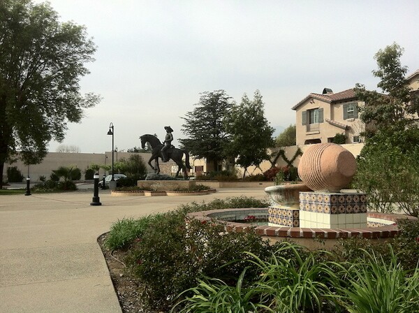
Other nearby sites of potential interest include Duarte's small civic center, Justice Brothers World HQ & Racing Museum, and Plaza Duarte -- a small courtyard with a burbling fountain surrounded by apartment buildings, and home to a handsome bronze statue of Andres Avelino Duarte, designed by sculptor Richard Myer and dedicated in 2007.
Monrovia
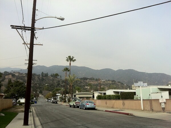
The portion of the city of Monrovia through which the 187 passes is sometimes referred to as the Technology Corridor, which frankly sounds more exiting than it is unless (like me) you find business parks strangely appealing. This portion of the 187's route will likely be hugely transformed by arrival the Gold Line and subsequent transit-oriented development. Nearby to the south, the large Station Square Transit Village (and a large maintenance yard) are already under construction. What charms Monrovia presently possesses are mostly contained within its small Old Town area, not visible from the 187's route, but just a short walk to its north.
Arcadia
Arcadia is probably best known for Santa Anita Park, a thoroughbred racetrack that opened in 1934. Personally I have next to no interest in horse racing -- my own foggy memories of attending the Kentucky Derby revolve exclusively around the meals served at Churchill Downs. Perhaps that's why the race track is more interesting to me as the home of the 626 Night Market. After a chaotic start in neighboring Pasadena, the large culinary event (inspired by those in Taiwan and other Asian countries) moved to what's perhaps its natural home, since Arcadia is today widely celebrated for its Taiwanese food scene. Nearly one in three Arcadians were born in Taiwan; roughly one in four were born in China. Popular Taiwanese innovations and specialties such as bubble tea, dim sum Mongolian BBQ, soup dumplings, stinky tofu, xiaochi, etc are found in abundance in Arcadia, including along Huntington Drive -- the city's restaurant row.
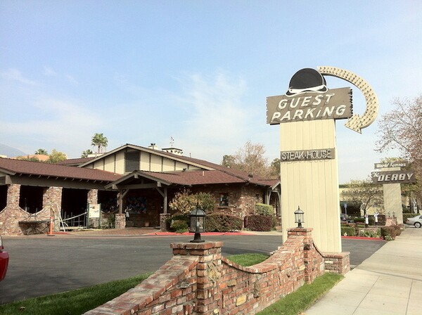
Huntington is also the main street of Arcadia's downtown and the 187 stops along it at Arcadia County Park, The Derby Restaurant, The Gilb Museum of Arcadia Heritage, and Claro's, a sizable Italian market, an institution since 1948, which in addition to Italian products offers a selection of Argentine, French, and Greek products. I'd imagine that it's the presence of the racetrack that at least partially is the reason for existence of Acradia's several dive bars, bingo parlors, motels, and a blues club too.

East Pasadena
Between Arcadia and the final city on the 187's route, Pasadena, is the tiny, mostly residential, and unincorporated community of East Pasadena. East Pasadena's best known eatery is The Original Tops, which opened in 1952 (although the current structure was only built in 1978). There's conceivably more of interest to some riders in the tiny neighborhood, but having thoroughly explored it in the past for the Amoeblog, I decided to wait to disembark until Pasadena.
Pasadena
The city of Pasadena may only be Los Angeles County's ninth largest, but having incorporated in 1886, it's the second oldest (after Los Angeles). Culturally, few would argue that it doesn't offer much more of interest than do larger cities like Lancaster, Palmdale, and Santa Clarita. The 187 passes by the PCC (home to a large and popular flea market on the first Sunday of every month), the South Lake District, the Playhouse District, the Civic Center, and Old Town -- districts which offer a healthy portion of the city's chief attractions.
The 187 offers riders the chance to visit the Pasadena Playhouse, Laemmle's Playhouse 7 (one of the county's premier "art house" cinemas), museums (the Norton Simon Museum, the Pacific Asia Museum, the Pasadena Museum of California Art) and many fine examples of beautiful architecture in the form of numerous cathedrals, civic buildings, homes, schools, and more. Amongst the relatively high density, greenery, and high culture, there's also ample public transit, great dive bars (e.g. the Colorado), and unpretentious affordable and tasty dining options, even including beloved local chains like King Taco.


*****
The Gold Line is scheduled to reach Azusa in 2015. Although there's seemingly no time table (or funding) in place, it's ultimately supposed to reach Ontario International Airport, thereby connecting the Inland Empire to Pasadena in about 40 minutes (compared to the roughly two hours that it takes for the 187 to make a similar journey). I wouldn't be surprised if at that point the route of the 187 will then be altered somewhat, but I have no doubt that it will continue to provide easy and comfortable access to both well-known and obscure treasures awaiting discovery.
Other lines of Foothill Transit offer easy access to many other area attractions. The communities of the southeast San Gabriel Valley -- including Diamond Bar, Hacienda Heights, Rowland Heights and Walnut -- are closer to the Inland Empire and North Orange County than to Los Angeles. They're also home to Asian-American pluralities and a thriving dining and nightlife scene boasting teahouses, karaoke, nightclubs.
Other sites accessible by Foothill Transit include schools (Cal Poly Pomona, Mt. San Antonio College, Rio Hondo College, Southwestern Law Schoo, and the University of La Verne), theaters of note (The Vineland Drive-In, CGV Cinema, and The Wiltern), malls and shopping centers with more than just Bed, Best Buys, and Beyonds (Hacienda Center, Hong Kong Plaza, Towne Center Village Shopping Center, Diamond Plaza, The Village at Indian Hill), large regional parks (the Santa Fe Dam Recreation Area, Whittier Narrows Recreation Area, Frank G. Bonelli Regional Park, Peter F. Schabarum Regional Park) and other attractions like Hsi Lai Temple (the largest Buddhist Temple in the Western Hemisphere), the dinosaur-themed Jurassic Restaurant, the historic Workman and Temple Family Homestead Museum, a McDonald's only used for filming commercials and the film "Mac & Me," Grand Avenue on Bunker Hill, the Pomona Fairplex, the Rose Bowl, and Walnut's famed Donut Tree restaurant.
If you enjoy good eating, culture, or just memorable experiences then the San Gabriel Valley is no doubt already on your radar. Thanks to our vast network of public transportation, you can leave to driving to someone else and explore cheaply, consciously, a and comfortably. See you in the SGV -- most likely on Foothill Transit.

