Exploring Public Art Along The South Bank of the L.A. River in Studio City

Studio City has two new, small, linear parks, each showcasing a slightly different approach to the revitalization of the Los Angeles River. Though the river channel is concrete, it's a great place to walk and check out the parks with their native plants, public art, and river rock walls, ramps, and benches. This 1.9 mile stretch of the river is very popular with pedestrians, joggers, and folks walking dogs.
STARTING POINT
Laurelgrove Avenue Footbridge, intersection of Laurelgrove Avenue and Valleyheart Drive. Studio City, CA.
DIRECTIONS TO START
Bike: There is no river bikeway in this area. From the Metro Red Line, disembark at the Universal City station and bike west on Campo De Cahuenga Way, crossing over the 101 Freeway. Turn right on Ventura Boulevard and turn right again on Laurel Grove Avenue which dead-ends at the park and footbridge.
For a less direct, very pleasant route on a street lined with great old oak trees: Make a hard right onto the pedestrian way at the corner of Campo De Cahuenga and Ventura Ventura Boulevard. This lets out on to a very short section of Riverton Avenue. Turn left onto Bluffside Drive and turn right onto Vineland Avenue. Cross the river, and turn left onto Aqua Vista Street. Turn left onto Fair Avenue and then turn right onto Dilling Street. Once you pass Tujunga Avenue, enjoy the wonderful canopy of tall old oak trees. Turn right onto Troost Avenue, where you will see Michelle Armitage's re-used metal sculpture of a knight fighting a large foe. Turn left onto Chiquita Street and then left onto Colfax Avenue.
As you cross the river, you can see the confluence of the Los Angeles River and the Tujunga Wash on your right. Turn right into the alley (before Ventura Boulevard), cross Radford Avenue and continue straight on Ventura Place. Cross Laurel Canyon Boulevard and ride upstream (in the paved river right-of-way) to the footbridge.

Transit: Take the Metro Red Line to the Universal City Station and follow the signs toward the rapid bus. Board the Ventura Boulevard Rapid (#750) and get off at Laurel Canyon Boulevard and walk one block north to the L.A. River. Turn left and walk west (upstream) along the LA River to the Laurelgrove Ave. Footbridge.
Car: Exit the 101 Freeway at Laurel Canyon Boulevard in Studio City and go south on Laurel Canyon Boulevard. Turn right onto Moorpark Street and left onto Laurelgrove Avenue. Proceed 2 blocks to the end of Laurelgrove Avenue at Valleyheart Drive. Street parking is available on Laurelgrove or Valleyheart.
WALKING DIRECTIONS
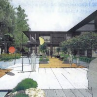
At the south bank of the L.A. River on the Laurelgrove Avenue Footbridge, turn left and descend the ramp into the L.A. River Greenway Park. This small linear park, which opened in 2004, occupies the southern bank of the L.A. River for approximately 0.6-miles from Laurel Canyon Boulevard to Whitsett Avenue. The park features extensive river-rock ramps (including a connection to the city's new Studio City parking structure), a series of clever rock seating areas, and native landscaping, which are welcoming and enjoyable.
Continue walking downstream and ascend the ramp at the Laurel Canyon Boulevard Bridge (the first bridge you encounter). Turn left onto the sidewalk, crossing the bridge. Turn right onto the crosswalk; watch out for oncoming traffic as you Cross Laurel Canyon Boulevard. Turn right on the sidewalk.
From the downstream side of the bridge, you get a good view of the weir on the south side of the river at Laurel Canyon Boulevard. Weirs are placed at some river confluences with large storm drains. In this case the structure drains the Laurel Canyon hillsides. To prevent local flooding, the weir spreads out the tributary flow entering the river.
Turn left into the Great Toad Gate. You've just entered the Valleyheart Greenway (note that Valleyheart Drive parallels the L.A. River through the east San Fernando Valley), a joint project of the County of Los Angeles and The River Project (with initial funding from the California Coastal Conservancy). This quarter-mile mini-park opened in 2004, with additional art features added in 2005.
Under the leadership of Melanie Winter and The River Project, the park was designed with input from students at the nearby Carpenter Avenue Elementary School. Students came up with ideas for the whimsical toad gate and butterfly garden and bench, and the ideas were further refined by artists. The Great Toad Gate was designed by artist Lahni Baruck, based on a drawing by student Michael Harris.
Descend the ramp. Chose the high path or low path to continue walking downstream. Note that instead of asphalt, the county has used decomposed granite (fine rocks that resemble natural earth), a more permeable and environmentally friendly walking surface.
On your right is the Rattlesnake Wall, a river rock retaining wall designed as a gigantic rattlesnake. The rocks are engraved with the names of students and others who worked on this park.

A few steps farther is the Butterfly Garden. The site features beds of various California native flowers, which attract butterflies. The various beds of the garden are in the shape and pattern of a butterfly's wing. Check out the beautiful Butterfly Bench. It's also designed by artist Lahni Baruck, and includes a quote from Henry David Thoreau.
Continue downstream, and then ascend the ramp to Radford Avenue. Turn left, walk across the Radford Avenue Bridge. If you look downstream from the bridge (into the CBS Studio Center), you can see the river water gathering into the low-flow channel. The low-flow channel in the middle of the river is provided to focus the water's gradual erosive power into a small area that is easier to maintain and repair.
From here, turn around and retrace your steps. When you get to the Laurengrove Avenue Footbridge, you can continue under it to see the rest of the city park, which ends at Whitsett Avenue.


